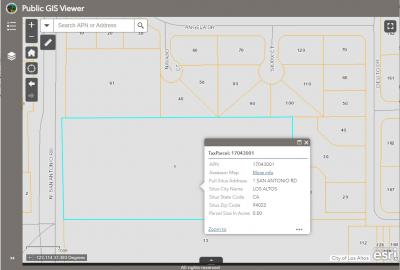
Public GIS Viewer
The city of Los Altos’ Interactive Geographic Information Systems (GIS) Map provides the public with information pertaining to zoning and land use, parcel data, historical property designation, tentative FEMA flood zones, and more. Individual parcels can be searched for via street address or APN (assessor parcel number).
If you have questions on the information in the GIS layers, please contact the Planning Division at Planning@losaltosca.gov.
To access the city of Los Altos Public GIS Viewer.
PDF files of the Land Use Map and Zoning Map can be found under Development Services Adopted Plans.
To find a property using Interactive GIS Map
- Go to the city of Los Altos Public GIS Viewer
- To search a property:
- Use the mouse-wheel, zoom in to see parcels and select a parcel; or
- Enter address, APN, point of interest, or place name with the Search bar widget:
- Search by Address: Enter a street number and street name in the search box (with street direction) then related results will be centered in the map window.
- Search by Assessor Parcel Number: If you know the Assessor Parcel Number (APN), enter the APN (with no space and no dashes) in the search box.
- View additional instructions for using the Public GIS Viewer.
Disclaimer:
The information on the GIS map was derived from digital databases on the city of Los Altos' GIS. The city of Los Altos does not guarantee that the data provided is free of errors or omissions, or the positional accuracy, and it should be verified.
In the case of discrepancies, the adopted 2018 Zoning/Land Use Maps, with amendments in Ch 14.88, have priority.

